Finetrack staff activity blog
For everyone here at Finetrack, outdoor sports is deeply integrated into our everyday lives. We long to spend time in places where we can fully immerse in nature and give in to the experience and beauty of it all. We find that through the joys of these moments, we are able to derive inspiration and innovative ideas for our products.
Posted by: Noriyoshi Shimizu
■ Photos: Yuta & Noriyoshi
After completing the Nose, the original plan was to tackle a variation route on Mt. Whitney. However, a severe cold wave and the extra time spent on the Nose left too few days to attempt it. While weighing our options, we stopped by an outdoor shop in Yosemite and sought advice. The staff eagerly recommended Bishop: "It has great climbing areas, the High Sierra mountains are nearby, and it's warm—perfect for outdoor activities. My friend just moved there recently..." After hearing this enthusiastic recommendation, along with a few digressions, the idea of escaping the cold wave in Yosemite Valley became appealing.
The next day, we headed to Bishop. While flipping through topos and chatting with the staff at the local outdoor shop, we were once again enthusiastically recommended a route: Bear Creek Spire (4180m), North East Ridge (5.5 ★★★★). Collecting information locally and deciding to climb it felt like the start of an exciting adventure, so we went for it.
September 19: Travel from Yosemite to Bishop
September 20: Visit outdoor shops, obtain permits, and bouldering in Bishop
September 21: Hike on the Whitney Trail for altitude acclimatization
September 22: Approach to Bear Creek Spire
September 23: Summit attempt and descent of Bear Creek Spire
September 24-27: Return flight from San Francisco Airport to Japan
Activity Dates: September 19 - September 24, 2022
September 22, 2022
On the approach, we hiked through Little Lake Valley. The landscape was serene, giving us the chance to fully take in the surrounding nature. However, even at the parking lot, the altitude was already close to 3,000 meters, a stark reminder of the massive scale of the terrain as we set off on the trail.
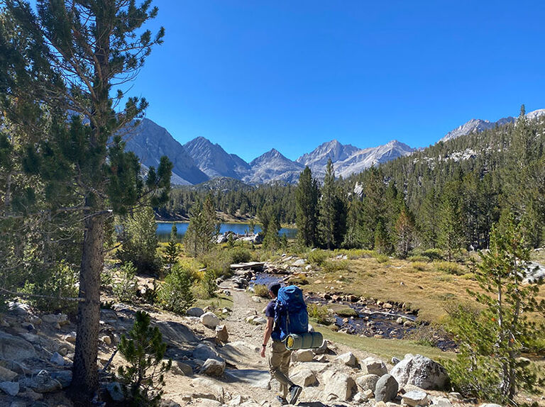
Despite the high altitude, there were many people who seemed to be out for a casual family hike—something you wouldn’t typically see at 3,000 meters in Japan. We were also surprised by the large number of people hiking with their dogs, a sight quite different from what we’re used to back home.
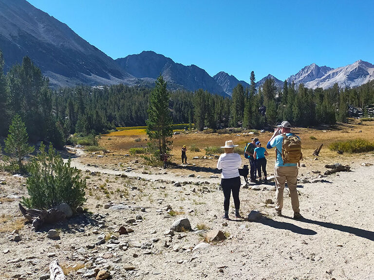
As the name suggests, Little Lake Valley is dotted with beautiful lakes, and many people were trout fishing along the way. The serene lakes added to the picturesque scenery, making it a peaceful and enjoyable hike.
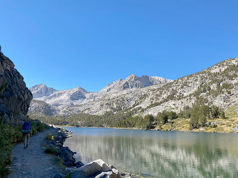
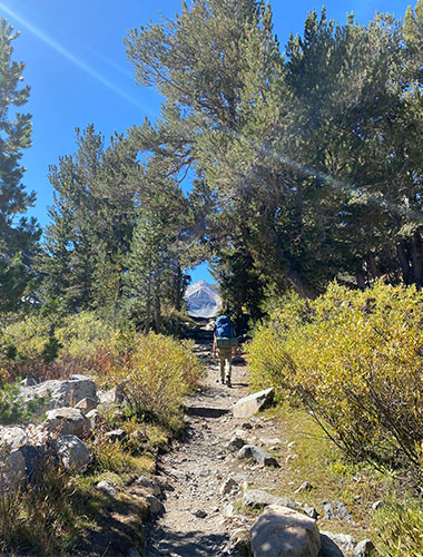
This was my first time hiking a trail in this region, and it was truly stunning. Even though I'm not usually a fan of long hikes, I found myself starting to get hooked on hiking thanks to the beauty of this trail.
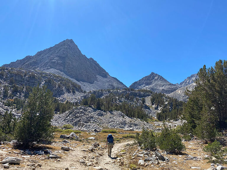
We continued walking, taking in the magnificent scenery. Just before reaching Gem Lake, we left the hike trail.
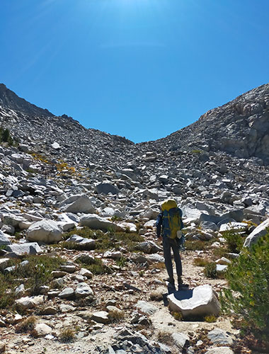
We followed the waterlines on the topographic map, gradually gaining altitude. Although we had braced ourselves for the many rocky areas like in the photos, the rocks in this area, despite being scree, were surprisingly stable and easy to walk on.
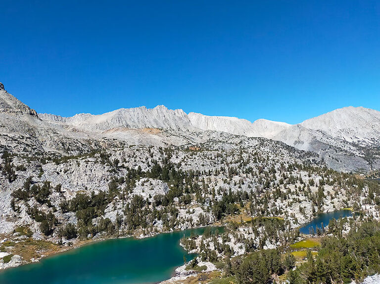
Looking back, we saw a landscape full of rocky peaks. With so many mountains, there must be countless unclimbed routes, right? We couldn’t help but imagine the potential climbing routes on the surrounding peaks.
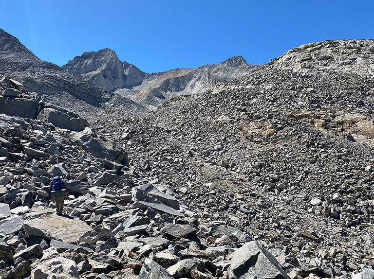
After walking over the rocky terrain for a while, Bear Creek Spire finally came into view.
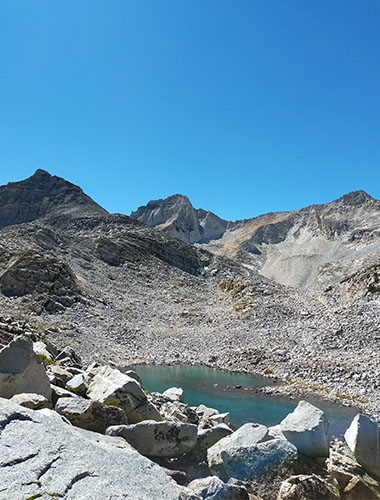
The ridge extending directly from Bear Creek Spire is the North East Ridge, the one we are climbing.
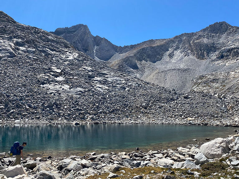
Walking along the shores of a beautiful, unnamed lake, we began our final ascent. Although we took our time, we arrived at our destination, Dade Lake, about five hours after leaving the trailhead.
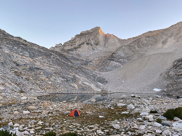
Dade Lake, our campsite, was a beautiful lake with a flat lakeshore, making it a very comfortable spot. Best of all, the route we were set to climb the next day was right in front of us, creating a fantastic base camp that boosted our motivation.
September 23, 2022
We started walking at 4:30 AM. Although the terrain was rocky, there weren't many fragile areas, making it relatively easy to walk.
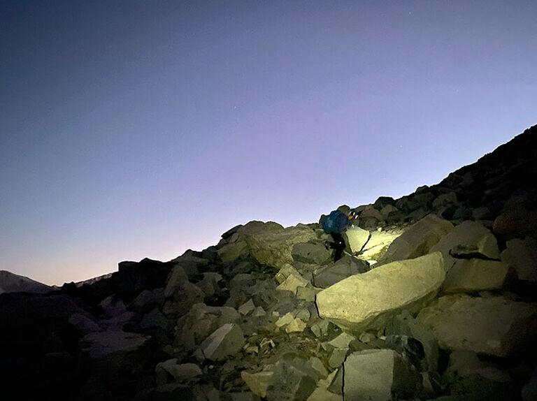
We paused to admire the beautiful Morgenrot, the Alpenglow of the sunrise. With few mountains obstructing the view, we could see the distant mountain ranges clearly.
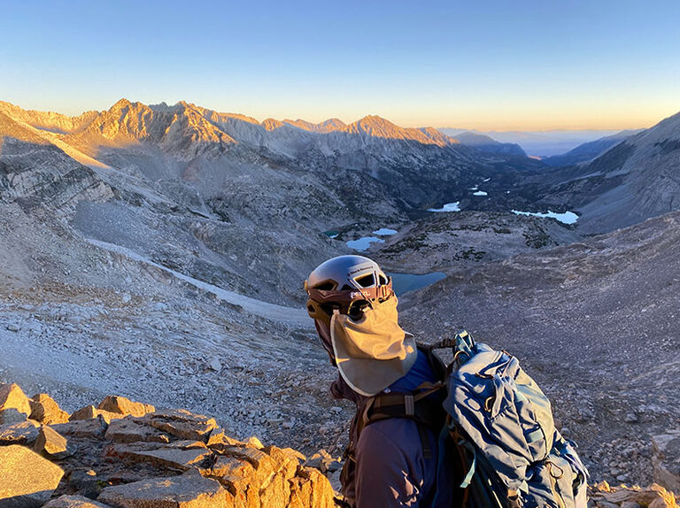
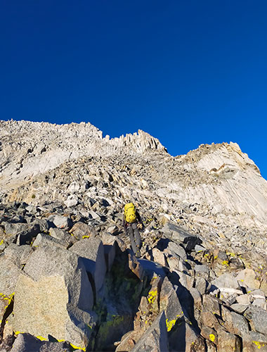
After about an hour and a half of walking, the ridge began to narrow, so we put on our harnesses. It seemed like the 3rd-class section on the topo had begun, but ropes didn’t seem necessary yet. Other parties might make different decisions here.
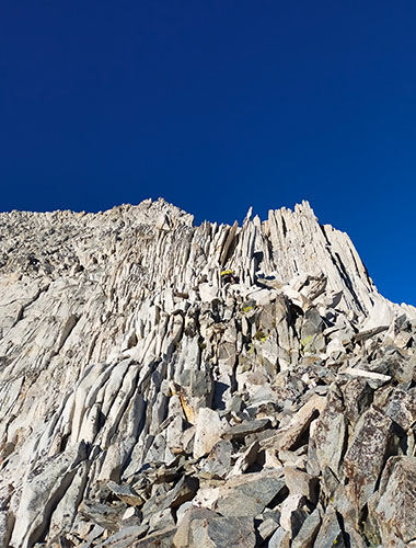
This striking appearance of the rock, resembling stacked flakes, was the reason we chose this route, so our excitement grew as we approached our target. The mountain overall seemed to have rocks that form vertically stacked, flake-like formations, but it’s rare to see them so fractured.
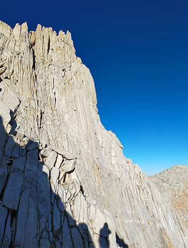
The ridge visible nearby is impressive as well. There’s a route called the North East Arete, graded around 5.9, and this mountain features solid rock with well-developed fractures, promising excellent climbing opportunities.
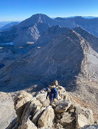
We steadily gained altitude on rock terrain around grades II to III. Although the rock appears to be made of thin, stacked flakes, it is surprisingly solid, with almost no loose or movable pieces. It was a refreshing climbing experience.
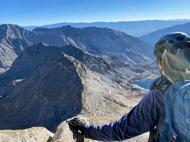
Looking back, the mountains stretched endlessly. Across from us, I could see the John Muir Trail winding along the neighboring mountain. I’d love to hike it someday.
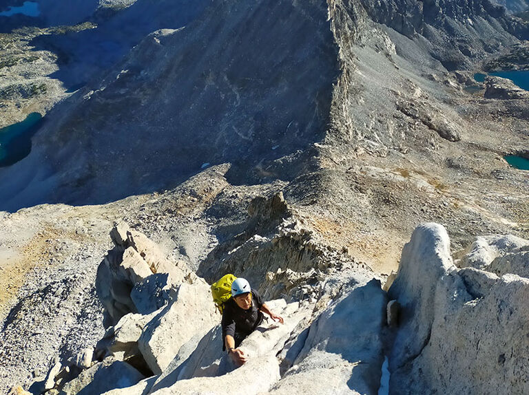
We continued to gain altitude on the rocky terrain without a rope. The well-developed fractures allow for jamming anywhere, giving us the freedom to choose our own routes. Each of us climbed intuitively, going wherever we wanted.
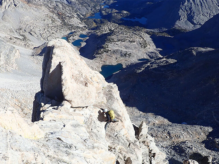
After climbing to a certain point and nearing the ridgeline, we pulled out the rope.
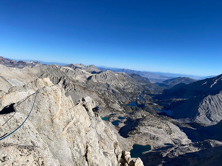
We extended the rope, savoring the sense of altitude.
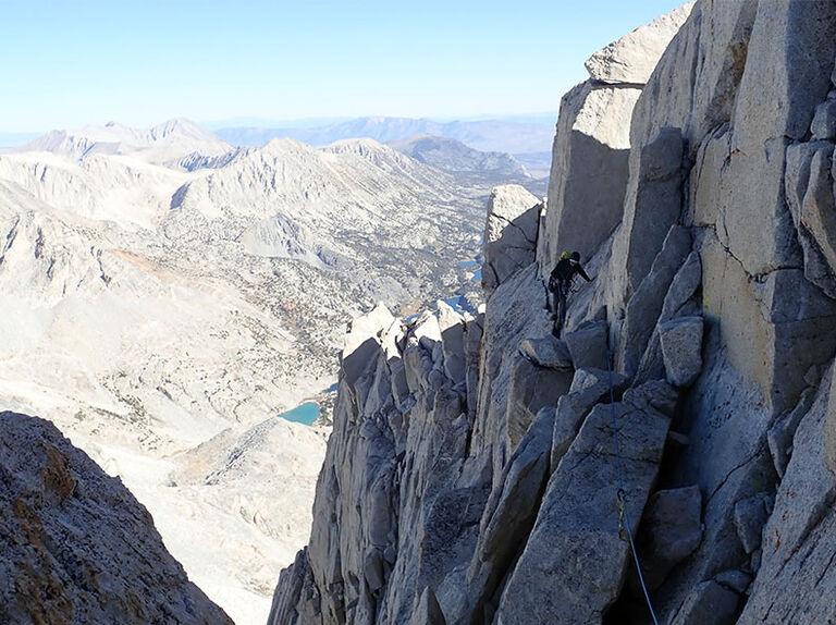
During the climb, we found no remnants of previous climbers, so we had to create belay points using slings and cams. Given this area’s reputation for classic routes, I expected signs of previous climbers, but I was surprised by the pristine condition—there wasn’t a single piton in sight.
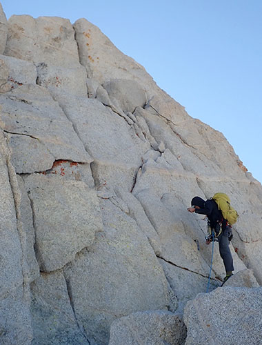
After climbing about five pitches in tandem style, we reached the wall just below the summit. The belay point was in the shade, with some lingering snow, and by this point, the wind had picked up, making it quite chilly.
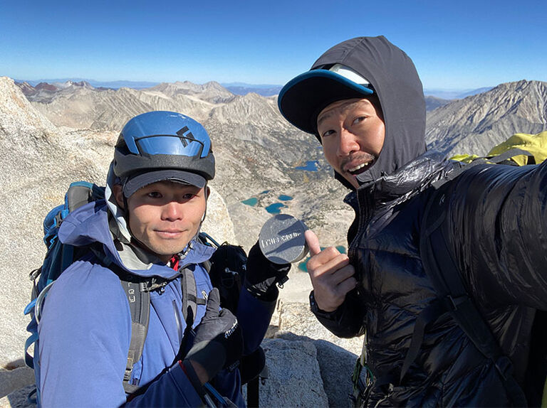
As we climbed the final rocky section, we found a silver can wedged in the rocks. Upon closer inspection, the lid read "This end UP!" and inside was a note with messages from climbers who had come before us. At 10:40, we reached our first summit above 4,000 meters!
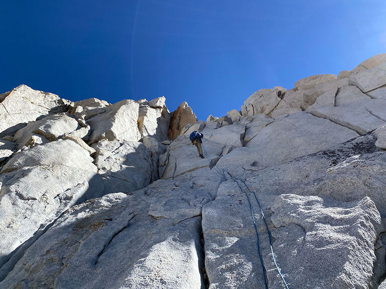
Due to the strong wind and extreme cold at the summit, we began our descent without lingering too long in reflection. We rappelled from the only remaining anchor on the route. A single 30-meter rappel brought us down to a stable spot, where we packed away the rope.
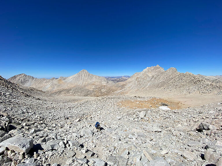
After descending a bit, the ridge blocked the wind, offering some respite. Surrounded by a landscape that felt like another planet, we were struck by the deep blue of the sky at this high altitude as we continued our descent.
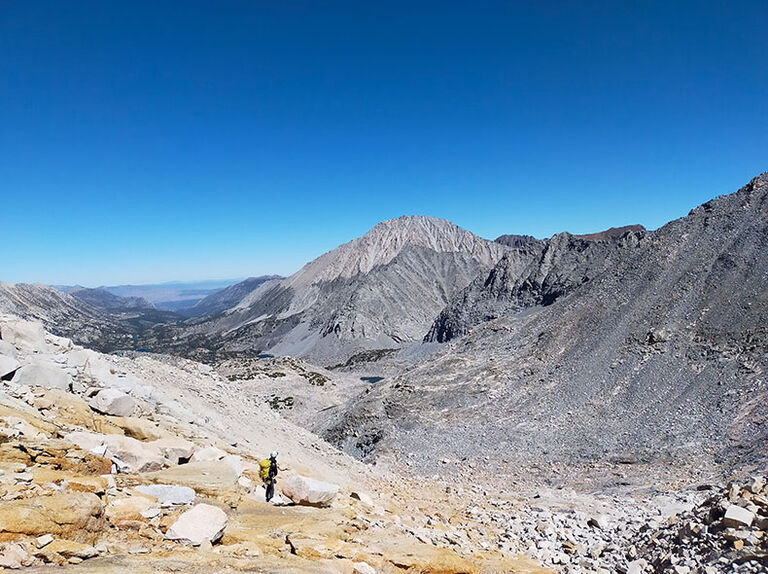
Crossing over the ridge, Dade Lake came into view. However, due to its immense scale, even though we could see it, it was still quite a trek to reach—just as we had felt during the approach. Despite the thin air causing a slight headache, our spirits remained high as we continued the descent.
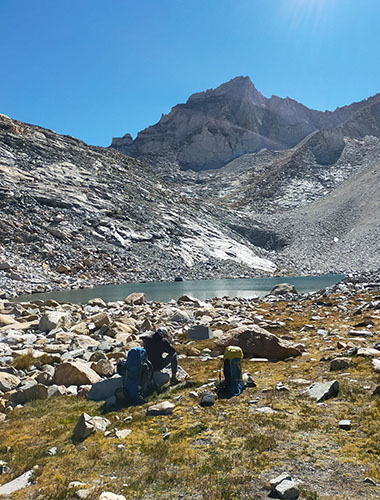
We arrived at base camp around 1:00 PM. It felt warm here, a stark contrast to the cold at the summit, making it quite comfortable. Resisting the urge to fall asleep was tougher than the climb itself as we packed up. Fighting off the temptation to relax, we began our descent.
Notes
The North East Ridge we climbed was technically the most challenging section, around IV+, but with straightforward route-finding, making it an excellent choice for a first US alpine experience. Here, I’ll briefly outline the details below.
Gear Used During the Climb
Rope: 60m single rope (only one)
Climbing gear: 1 set of cams (#0.4 to #3), 6 alpine quickdraws
There are essentially no fixed belay points or remnants, but the rock is solid with well-developed fractures, making it easy to create anchors with slings and cams. However, the route continues for about 200–300 meters of IV-grade rock, so relying solely on the rope can make for a long climb. You’ll need climbing ability and stamina to sustain the pace. We climbed the lower sections without a rope, using it only for the final five pitches on the ridge, with minimal protection.
Approach
Water: There are many lakes, but a water filter is necessary. Since we didn’t have one, each person carried 4 liters to the base camp.
Permits: Bear Creek Spire lies in a restricted area within a national park, requiring an entry and overnight permit. You can apply on the U.S. National Park Management site, Recreation.gov, though it can be a bit confusing. We applied locally at the White Mountain Public Lands Information Center in Bishop, which is recommended.
Bear Protection: As this area is in a bear protection zone, a bear canister is required. You can buy or rent one at local outdoor shops, but it’s best to borrow one from the ranger station. The canister can be returned to other ranger stations in different towns and can be dropped off in a mailbox outside the building, making it convenient for travel.
Other Information
Topo Reference: We used the High Sierra’s Super Topo guide, along with posts from general climbers on the Super Topo site.
Topographic Map: We used the Gaia GPS app, which is free, allows data caching, and worked well for our needs.
Camping: We stayed at the Pleasant Valley Pit Campground in Bishop. Although it lacks showers, water facilities, and cell reception, it’s close to Bishop and costs only $10 per night. The starry sky from this American wilderness campsite was magnificent, making it a highly recommended spot.
