Finetrack staff activity blog
For everyone here at Finetrack, outdoor sports is deeply integrated into our everyday lives. We long to spend time in places where we can fully immerse in nature and give in to the experience and beauty of it all. We find that through the joys of these moments, we are able to derive inspiration and innovative ideas for our products.
Posted by: Sou Aikawa
■ Photos: Aikawa, Ryoji Onishi, Akira Tanaka
Looking up, I could barely glimpse the sky at the far-off zenith. The towering sidewalls, more than 100 meters high, leaned inwards, creating an overhang that made the gorge feel like an immense cave—offering no way out. Though there weren’t any towering waterfalls plunging from great heights, the water flowed horizontally in places, making the entire scene feel like one endless, cascading torrent. The glacial meltwater, cold as ice and immense in volume, surged relentlessly through this isolated, otherworldly space.
This surreal and overwhelmingly remote place was Gloomy Gorge—the most daunting gorge I had ever encountered.
Known as "the world's most difficult canyoning challenge," Gloomy Gorge is located on the western face of Mt. Aspiring in New Zealand’s South Island. In 2012, a French team first scouted and established routes here. The following year, one member of that team joined a group of four New Zealanders to complete the first descent, a grueling 20-hour journey that stretched through the night. Since that remarkable achievement, no one has dared to attempt the descent again.
For Onishi, the mastermind behind our expedition, this descent had been a three-year obsession. After scouting the gorge from above in 2015, he remained unwavering in his determination to conquer it. His resolve was truly inspiring, and I feel immensely grateful to have been part of this extraordinary expedition.
Date of the expedition: March 11–15, 2018
Attempting this descent onsite and overnight was simply out of the question. Even if we utilized any fixed gear left behind, the journey would still take at least 30 hours. We planned to spend three days traversing the gorge, estimating the entire expedition—including the approach—would take five days. However, it was uncertain whether we could find flat ground to sleep on within the gorge, so in the worst-case scenario, we were prepared for a sit-down bivouac.
Our team consisted of four members: Ryōji Ōnishi, myself, Jasmin, and the highly skilled canyoneer Akira Tanaka. I had previously joined this group during the first descent of Taiwan’s Chakanxi. With this lineup, we had assembled what was probably the best team for an expedition canyoning challenge.
March 11
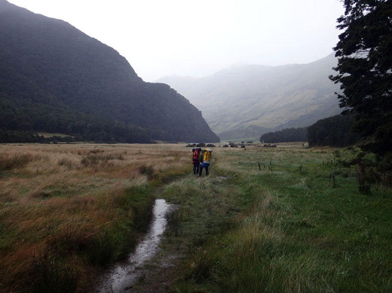
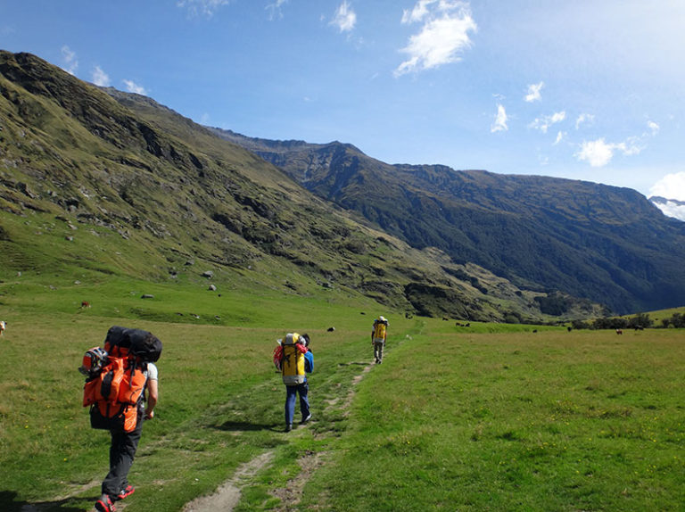
The first day involved the approach. We followed the scenic West Matukituki Track, burdened by the weight of our gear. As is typical for any canyoning expedition, we carried an overwhelming amount—each pack weighing over 25 kilograms on average.
March 12
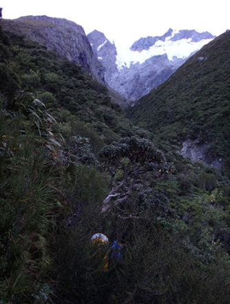
We set off before dawn, ascending the French Ridge Track to 1,100 meters. From there, we descended through dense scrub on the right side, making our way toward Gloomy Gorge. A single rappel brought us down to the riverbed, and soon after, the gorge enveloped us. The volume of water was staggering, surging through the narrow canyon with an intensity that was impossible to ignore.
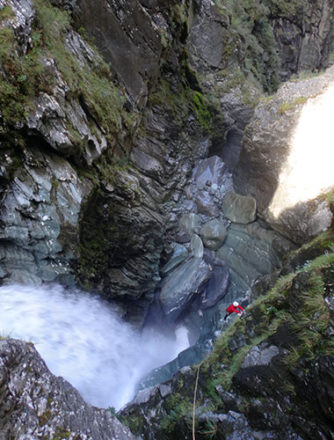
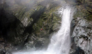
The first rappel. It appeared that the anchor points from the initial descent were still intact.
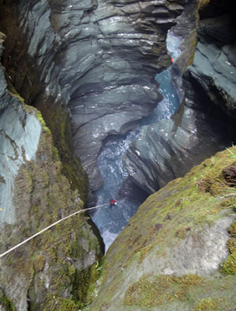
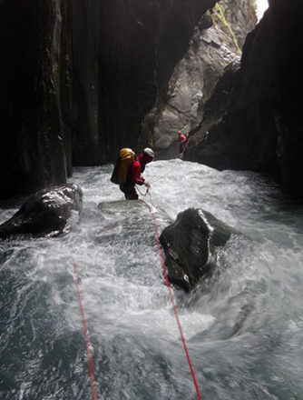
The gorge grew progressively deeper and narrower, transforming into a confined waterway. After rappelling down into the water, we swam through the swift current.
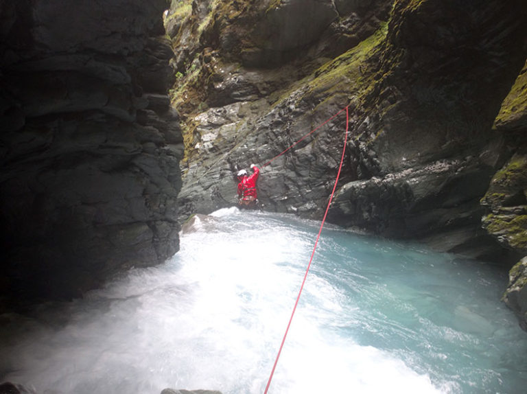
A terrifying waterfall loomed ahead. We cautiously traversed along the edge, just above the drop.
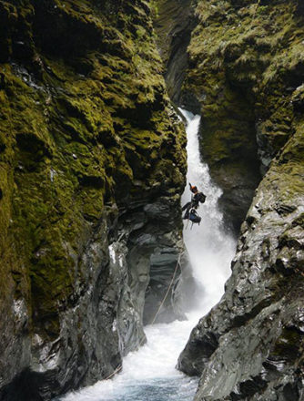
In canyoning, the standard technique involves descending by adjusting the rope length using a controlled lower-down method. Once you land in the water, you either detach from the rope and swim through, or rappel while keeping the rope taut to set a guideline.
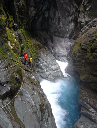
The most challenging aspect is the watercourse-like sections of the gorge, where it's impossible to land directly on the water’s surface. In Gloomy Gorge, this happens frequently, leaving traversing as the only option. However, with the heavy loads we were carrying, lowering the gear became essential, significantly slowing us down compared to simple rappelling. While the anchors and protections were reliable this time, descending without onsite route work seems nearly impossible.
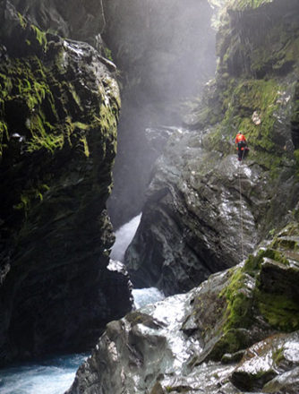
We untied the rope and carefully traversed the sidewall. In Gloomy Gorge, there were few places where I could walk normally once the rope was detached.
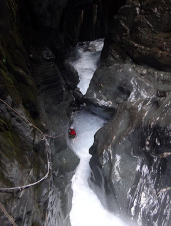
Once again, we rappelled while slightly traversing along the left bank. However, the section after landing in the water felt particularly risky, as we needed to climb onto the rocks quickly, with the danger of being swept away and trapped in a sieve.
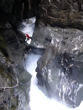
Somehow, we managed to scramble on top of the CS (Chockstone). In this valley, where every point felt critical, our descent was progressing painfully slowly. By now, it was already dusk.
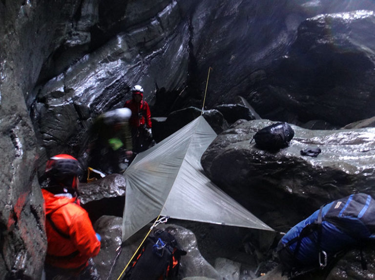
There was a small spot just to the right of the chockstone where it seemed possible to rest, so we decided to use it as our bivouac point. It was a cold, uncomfortable bivouac, constantly drenched by the spray from the nearby waterfall.
March 13
The second day in the gorge. After a short rappel, a space appeared to be opening up to the right. It was likely a large waterfall. We took a belay position and cautiously assessed the situation.
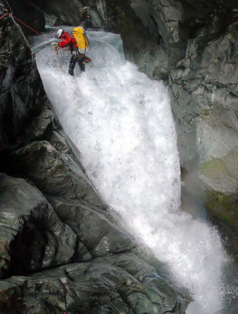
A dangerous waterfall indeed came into view. We had to navigate a tricky traverse right at the lip of the fall, and even though we were on belay, it would have been nearly impossible to recover if we were swept away. With extreme caution, we carefully searched for secure footing in the flowing water and somehow managed to complete the traverse. Akira, the lead, remarked that it was the most terrifying point.
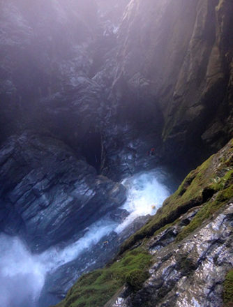
After a 40-meter rappel, Akira, who had skillfully read the water's flow, swam across the milky white basin. However, the second member, Jasmin, was nearly swept toward the lip of the waterfall, a truly alarming moment. Beyond the lip, a towering waterfall dropped another 60 meters.
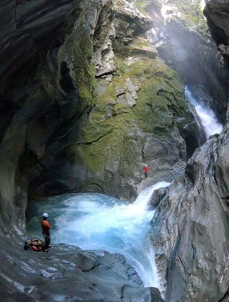
This is the kind of place it is. The two following members, frightened, opted to use the rope.
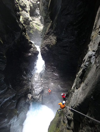
The watercourse in the gorge grew even more treacherous. Descending to the waterline was impossible—it was an endless traverse.
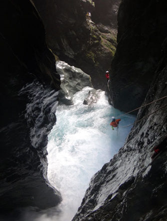
And then the Tyrolean traverse.
We gathered on a small rock at the drop point. It still seemed impossible to reach the waterline, so the traverse continued.
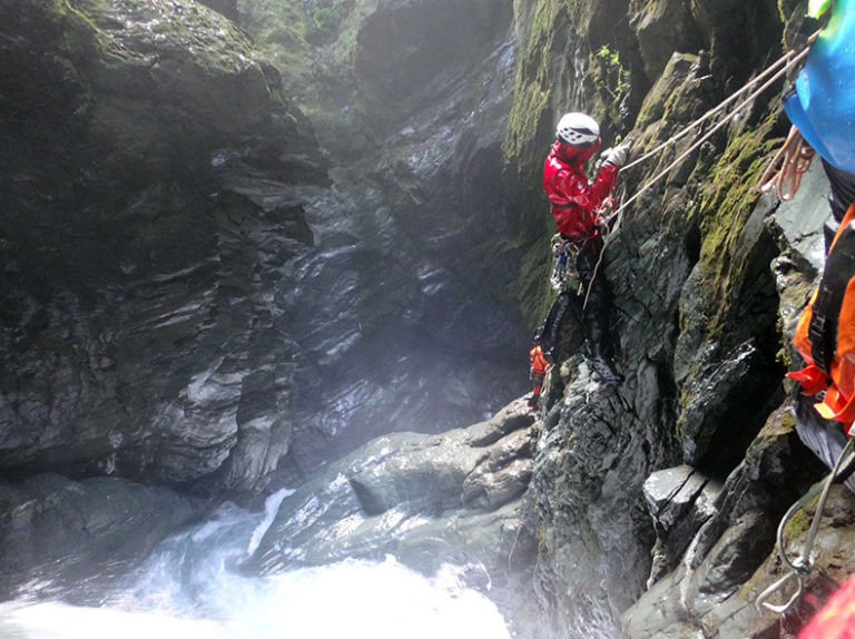
We emerged into an open space where a massive, turbulent pot was being pummeled by a powerful waterfall. After a 40-meter rappel, the leader swam through the churning water, while the rest of us exited using a guide line rappel.
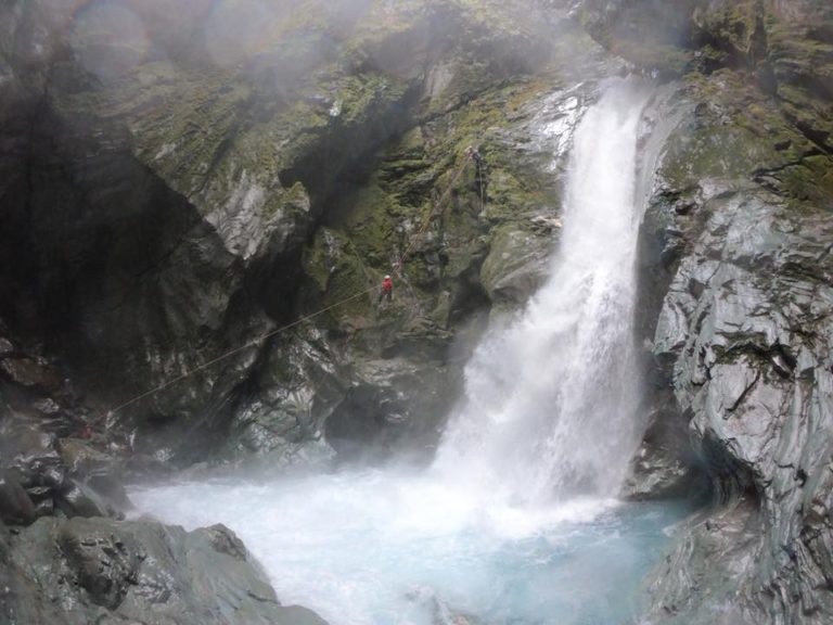
By this point, it was already 6 PM. Miraculously, we discovered a cave a little further ahead. Since it was around a bend, we were shielded from the waterfall's spray, making it the best possible campsite under the circumstances. We decided to make this our bivouac point for the second day in the gorge. I was astonished to realize that, after two full days, we had only managed to descend, at most, five waterfalls. In total, we had covered just 800 meters horizontally through Gloomy Gorge, with an elevation drop of around 350 meters. The exit still felt endlessly far away.
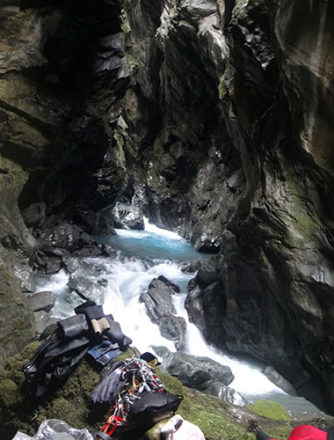
March 14
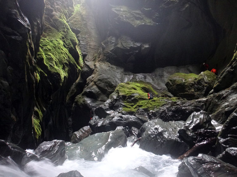
We had planned to exit the gorge in three days, bringing food for two nights along with some reserves, leaving the rest stored at the exit. With rain forecasted for tomorrow, we were eager to make our way out today. From the morning, we descended deeper into the cave-like gorge.
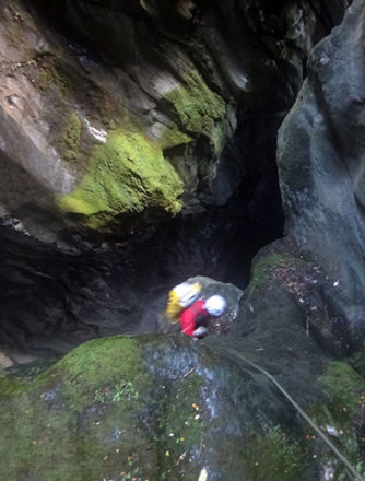
March 14
We had planned to exit the gorge in three days, bringing food for two nights along with some reserves, leaving the rest stored at the exit. With rain forecasted for tomorrow, we were eager to make our way out today. Starting early in the morning, we descended deeper into the cave-like gorge.
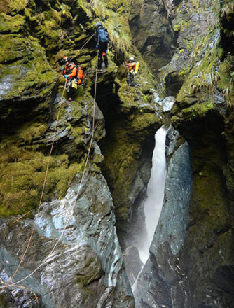
We then descended into an even darker section of the gorge, which felt more like a cave. Instead of widening, the gorge grew narrower and deeper as we went down, with steep, imposing side walls. A cold wind rose from the depths, adding to the eerie sensation that we were descending into the very heart of the earth.
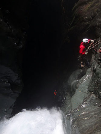
This cave-like section proved to be the most time-consuming part of the descent. While the bolts and fixed ropes left by the first descent team were still mostly intact along the walls, many of the ropes that extended away from the walls had been cut and were missing.
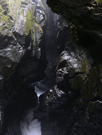
The leader used the fixed points to traverse the right bank for two pitches. When the fixed points ran out, he executed a technical rappel, swinging the rope gently like a pendulum to reach the left bank.
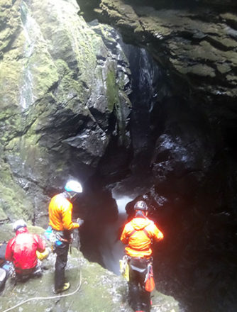
Following along, we struggled significantly with the complex rope work while hauling our gear. The descent brought us to an awe-inspiring space carved by the raging waters of a waterfall cascading from the cave. It was already past 5 PM, and the narrow gorges ahead suggested it would be difficult to exit today.
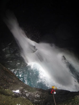
After climbing two pitches toward a ledge we had spotted during the descent, we discovered a relatively good bivouac spot, sheltered from the waterfall's spray. This became our camp for the third night in the gorge. For dinner, we shared some instant mashed potatoes and a small portion of rice.
March 15
Day 4 in the gorge. We began the day with a rappel from the ledge.
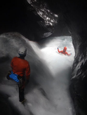
The waterway from this point made traversing difficult and troublesome. I spotted a potential landing spot ahead, so we decided to adopt a downstream strategy. We floated down a small drop and landed on a rocky ledge on the right bank.
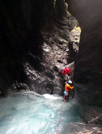
When we climbed up the right-hand wall, we discovered two massive chockstones wedged in a narrow section of the gorge, with a waterfall cascading rapidly beneath them, dropping sharply in elevation. The conditions were far from suitable for navigating along the waterline.
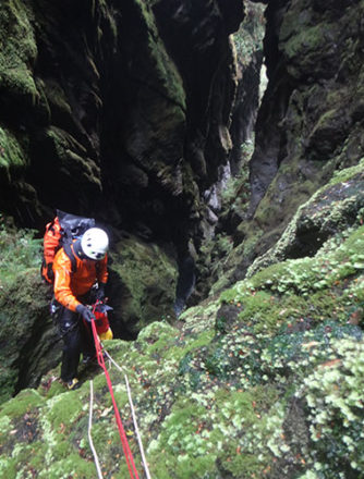
We descended toward the waterway, passing over the two massive chockstones wedged between the walls of the gorge.
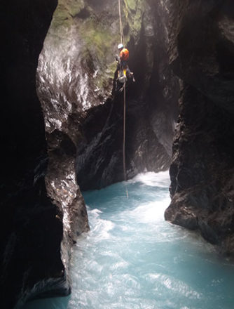
We landed in the water and swam through the fast-flowing current.
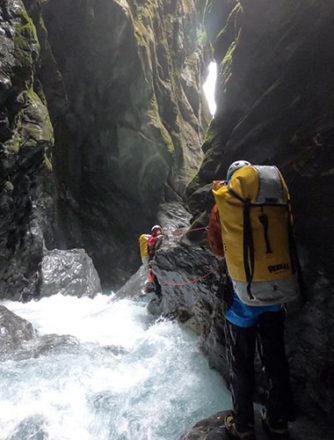
Was this the exit of the gorge? An open space was visible ahead, but we couldn’t let our guard down just yet.
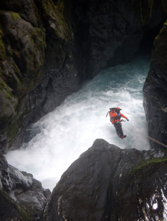
We jumped in after the rappel. Spotting a shallow area ahead, we carefully avoided the undercut on the right and swam through with ease.
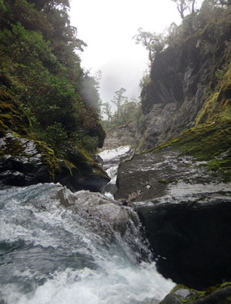
Finally, we made it out of the gorge!
After a one-pitch rappel through the open stream, it wasn’t long before we reached the main Matukituki River. The rain had started again, and I can say we were cutting it close. By the time we retraced our steps along the approach trail and reached the parking lot, it was already completely dark.
